The geography of ancient Rome played an integral part in the city’s development and history. Located along the Italian peninsula of the Apennine Mountains, the geographical area of Rome expanded significantly over time. Originally founded as a small village, Rome’s location, on the River Tiber, allowed it to become a thriving hub of trade and industry, becoming the most influential and powerful city of the ancient world.
The main city area of Rome included the seven hills – Caelian, Aventine, Capitolium, Palatine, Quirinal, Viminal and Esquiline – that ran along the western bank of the River Tiber, with the Forum Romanum located in the Valley at their base. It is said that these hills were formed during the Pliocene epoch, roughly two million years ago, although this is now disputed.
In addition to its location around the seven hills of Rome, the city was surrounded by the Tiber’s flood plain, which protected the Empire from sea-borne invasions. At points, Rome’s land also extended to the Alban Hills and Remus Hills of Lazio, to the south of the Italian Peninsula, while the Roman harbour of Ostia was located in the Tyrrhenian Sea, 20 miles south of Rome.
Rome’s unique geography enabled it to become the most powerful city of the ancient world. Its strategic inland location meant that it was safe from invasions. Additionally, the Tiber essentially acted as an internal highway, connecting Rome to other parts of Italy and providing access to the sea. Geography also allowed the city to easily access necessary resources such as crops, timber, minerals and animals from the local area, allowing them to be used to support the Roman Empire’s development. Additionally, the land in and around Rome has been said to be extremely fertile, providing the city with plentiful crops and allowing for it to sustain large populations.
Ultimately, the geography of ancient Rome not only contributed to its development and rise to power, but also preserved it – Rome was well-protected due to its location, enabling it to become one of the world’s longest-standing ancient civilizations. Today, the importance of understanding Ancient Rome’s geography is exemplified by numerous exhibitions, with the Galleria Borghese in Rome hosting a devoted exhibition, showcasing how the geography of the city benefited the development of Roman culture and traditions.
The Geographic Benefits of Ancient Rome’s Location
It is widely believed that the location of Ancient Rome, on the Tiber Valley, was a key factor in allowing the city to become the most powerful of the ancient world. The River Tiber enabled Rome to become a hub of communication between the regions of Etruria, Latium and Campania, providing access to essential resources. This allowed Rome to become an important centre of trade, with products being exchanged throughout the Mediterranean region.
The Tiber also provided a strong network of communication between Rome and its other provinces, reducing travel time and costs of transport. Additionally, the river allowed it to become a main centre of agricultural production – farms were located close to the river, allowing for plentiful crops and sustainment of the area. Roman agricultural techniques allowed them to comfortably feed their large population and provided surplus to trade, benefitting Rome and its allies.
Roads and bridges, constructed by the Romans, also connected Rome to its provinces and other surrounding towns, allowing for easy access and spread of ideas. While the rise of technology in the modern world has somewhat decreased the need for the growth of trade via roads and bridges, in the age of Ancient Rome, these two were integral for the expansion and spread of trade.
Climate and Roman Expansionism
The climatic conditions of Rome and its surrounding areas has also been an integral component in its growth as an Ancient Empire. The climate in Rome is typically Mediterranean, conducive to the cultivation of various crops. The area surrounding Rome has been said to have much favourable land, and the sea has enabled Rome to become one of the main centres of the Mediterranean. Additionally, the city’s location enabled its allies to have access to warm and clear waters, allowing them to trade with other areas of the Mediterranean.
The temperate climate of Rome allowed it to become an ideal area for some of the world’s most advanced technologies and agricultural practices. This, in combination with the Tiber River, enabled Ancient Rome to become the enormous Empire we know today. Furthermore, the Mediterranean climate of Rome and its surrounding area enabled the Roman Empire to grow and expand to other lands outside Italy.
The Romans began their expansionism outside the Italian peninsula in 271 BC, after the Battle of Pydna. Their external expansion was enabled by Roman military strength, technological advancements and favourable climatic conditions, which allowed them to take advantage of the resources and people they encountered in their conquest.
Landscape of Ancient Rome
The landscape of Ancient Rome played an integral part in its development over time. Most famously, the landscape of Rome includes the seven hills of the city centre, providing the Romans with prominent locations for political, economical and social structures. These hills provided agricultural land for the Romans for various crops, such as grapes, olives and wheat, with the Tiber Valley providing a favourable location for water-based industries and transportation. Furthermore, these seven hills provided the Romans with prominent sites for monuments and other public buildings, allowing them to celebrate their history and culture.
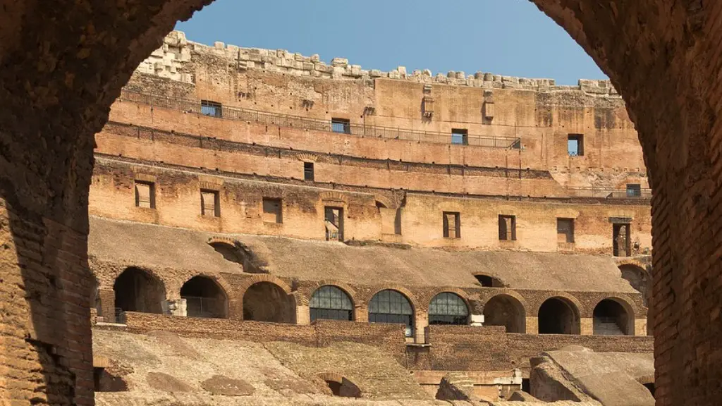
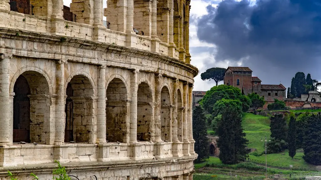
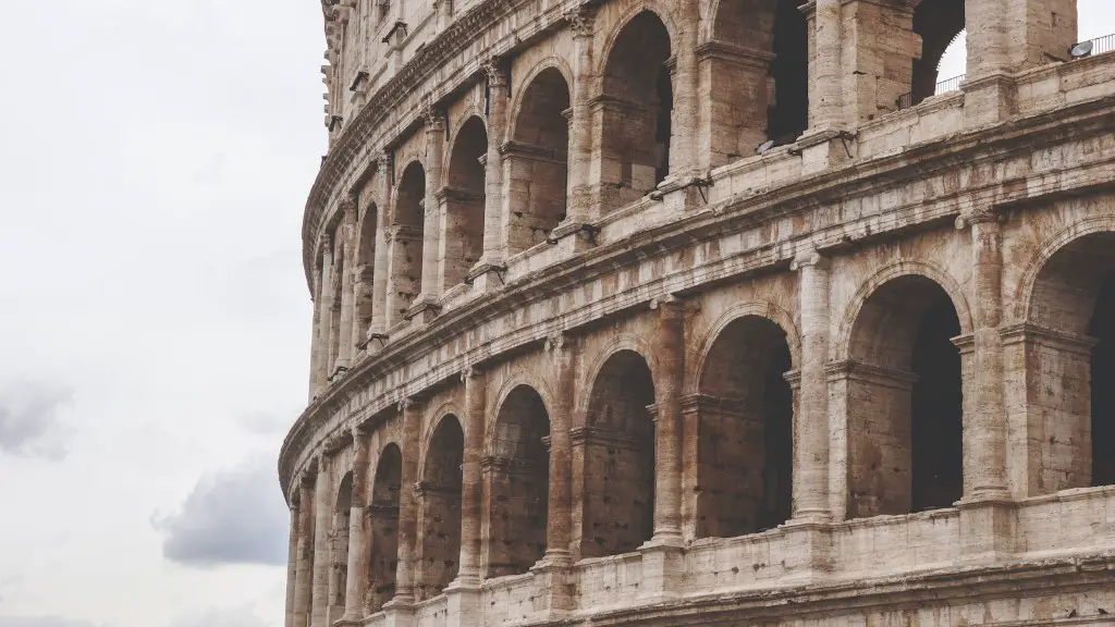
The city itself was renowned for its impressive architecture, with numerous grand public spaces. Most notably, the Colosseum was seen as a symbol of Roman pride and power, with its construction and grand appearance inspiring visitors from distant lands. Additionally, a large number of public baths were built in Rome and its surrounding areas, most famously the Baths of Caracalla and the Baths of Diocletian, showcasing the Romans’ ingenuity and advanced engineering techniques.
At the same time, the many Roman aqueducts are also a reminder of the city’s remarkable engineering achievements. These aqueducts enabled water to be supplied to Rome from distant areas and enabled the city to have access to this essential resource. Furthermore, the grand Roman architecture enabled Rome to become a tourist destination, inspiring visitors from foreign lands and increasing Rome’s monopolistic power.
Conclusion of Roman Geography
The geography of ancient Rome played a significant role in the historical development of the city, with its favourable and strategic location providing the Romans with access to important resources and lands around the Italian peninsula. Rome’s unique geographic position enabled it to become the most powerful and influential city of the ancient world, with its strategic location and favourable resources enabling the city to thrive both culturally and economically.
The landscape of the city is also a reminder of the Ancient Roman’s impressive engineering and technological advancement, with numerous monuments, public spaces and aqueducts around the city exhibiting their remarkable skills. Ultimately, the geography of ancient Rome was an integral component in its development and longevity – it is no wonder why, today, understanding and showcasing the Ancient Roman geography is so important.
